Wednesday, April 13, 2011

West Coast of Ireland, 8th - 11th April 2011

Connemara, West Coast of Ireland
8th - 11th April 2011

Two days of walking with seven friends: me (Mark), Giles, Chris, Tony, Luke, Nick, Dean and Stuart. A weekend of mountains walks during the day, and Guinness at Matt Molloys bar, Westport in the evening. Perfect.

Glencoaghan Horseshoe, Twelve Bens, Connemara
Challenging walk in the heart of the Twelve Bens mountain range, taking in five peaks including Derryclare, Bencorr (711m), Bencollaghduff (696m), Maumina (563m) and Benbreen (691m). The walk took us almost 8 hours to complete. Although only about 10km in distance, the walk included around 1,500m of ascent. The entire day was spent either climbing up or down rocky mountains, as there are very few flat sections along this walk. The main challenge was steep ground, with several very steep scree runs or rocky scrambles to negotiate. There was also one narrow and steep ridge to descend from Bencollaghduff, as well as a long and steep scree run from Benbreen. We then turned east from the col between Benbreen and Bengower back into Glencoaghan. A superb mountain day. Map and compass essential to ensure the correct line of ascent/descent as the walk is pathless in places and the route is bounded by some serious cliffs.

Glenlaur Horseshoe, Sheeffry Hill, County Mayo
A gentler walk (relatively speaking!) up onto the broad ridge of the Sheeffry Hills in Co Mayo. Parked near Sheeffry Bridge and then walked up into Glenlaur before striking south up onto the col on the southern arm of the horseshoe. Two quite steep climbs then ensued, with a long, flat and quite narrow ridge in between, up onto the broad summit plateau. This plateau is dissected by small streams, ponds and peat hags that was reminiscent of Kinder Scout. No paths whatsoever, so a compass bearing was essential to hit the small cairn that marks the 742m spot height. And what a view from this cairn, with Croagh Patrick and Clew Bay in the distance. From the summit, headed east to reach the brow of the steep and fairly narrow ridge that leads down into a narrow col on its northern arm. Then continued over a slight rise of land before a long and steep descent topick up a stream that took us back into Glenlaur. A total contrast from yesterday's walk - grassy/boggy underfoot, only one major climb and navigationally slightly more difficult because of the sprawling summit plateau.

Photographs copyright Giles Rocholl Photography http://www.gilesrocholl.com

GLENCOAGHAN HORSESHOE


GLENLAUR HORSESHOE


Photographs copyright Giles Rocholl Photography http://www.gilesrocholl.com

Thursday, March 31, 2011

Snowdonia Wild Camp

2-day Mountain Expedition - Snowdonia, March 2011

Cwm Eigiau Horseshoe, Carneddau


2-day mountain expedition around the Cwm Eigiau Horseshoe.

Route - set off lunchtime Monday; returned lunchtime Tuesday. 2 people (me & Nick).

DAY ONE - Cwm Eigiau car park (SH 732 663). Track to Cedryn, then ascended by old quarry workings onto Pen Llithrig Y Wrach, then followed ridge onto Pen Yr Helgi Du. Wild camped on summit of Pen Yr Helgi Du (830 metres). Warm during day, cold at night. Reasonable visibility, light winds. Rain shower at 5am.

DAY TWO - Bwlch Eryi Farchog (narrow and steep ridge, with some scrambling), Penywaun-Wen, Carnedd Llewelyn (1064 metres) then down into the saddle of Gwaun y Garnedd before striking eastwards across the broad plateau to reach the steep ground above Melynllyn (reservoir). Continued NE across the broad ridge skirting above the crags/outcrops above Llyn Eigiau before descending towards Cerrig Cochlon and back to the parking area.

This is spectacular route through remote mountains with a variety of terrain including moorland, mountain plateau, several mountain summits, narrow ridges (scrambles) and steep, rocky terrain. In poor visibility, precise navigation will be essential to safely find your way, particularly across Carnedd Llewelyn - OS Explorer OL17 and compass essential. The narrow ridge requires a head for heights and would be difficult/dangerous in high winds or poor weather.

When wild camping - wild camping is tolerated in most mountain regions, but follow these simple rules: ask permission to camp (if possible), keep your group size small, camp high (amongst the mountains) above the intake walls and away from paths, pitch late and leave early, protect water supplies, no fires and leave no trace whatsoever.


Wednesday, March 23, 2011

Lake District Wild Camp

2-day Mountain Expedition - Lake District, March 2011
Kentmere Horseshoe

2-day mountain expedition around the Kentmere Horseshoe.

Route - set off lunchtime Monday; returned lunchtime Tuesday. 4 people (me, Chris, Giles and Stu).

DAY ONE - Kentmere, Kentmere Reservoir, Ill Bell NE ridge (very steep in places), Ill Bell, ridge north to High Street, Nan Bield Pass, descend to Small Water (just as it was going dark). Low cloud and dense mist, cool but gusty winds.

DAY TWO - Mardale Ill Bell E ridge (Piot Crag), High Street, Ill Bell ridge all the way to Garburn Pass and return. Decided to re-walk this section as the mist/clouds lifted and we wanted to see the views and also experience this spectacular, long ridge walk.


Saturday, February 19, 2011

BBC Countryfile magazine

BBC Countryfile magazine
March 2011

Mark Reid has written a 2-page feature for BBC Countryfile magazine (pages 92 - 93, March 2011) about HOW TO USE A COMPASS.

BBC Countryfile also recommends Mark Reid's 2-day navigation courses in the Yorkshire Dales. Here's what they say...

Create your own countryside routes

Team Walking offer two-day walking courses in the Yorkshire Dales allowing participants to learn the basic map and navigation skills along with hill safety and access, whilst gaining either bronze or silver National Navigation Award Scheme (NNAS) levels. After completion you will be able to plan and follow your own walks in the countryside.

BBC Countryfile website: http://www.countryfile.com/navigation

TeamWalking website: http://www.teamwalking.co.uk/navigation_skills_weekends.html

Wednesday, February 09, 2011

Saturday, January 08, 2011

Ale and Hearty - Pub Walking in Northumberland

Ale and Hearty: Pub walking in Northumberland

The Inn Way... to Northumberland

Featured in today's Guardian (Saturday 8th January 2011)

www.guardian.co.uk/travel/2011/jan/08/walking-pubs-northumberland

" 'It's about appraising your place in the world. Artificial light is not natural, office light is not natural; walking is what we're meant to do." Well-trodden words for sure, but utterly convincing in the salty air – and when spoken by Mark Reid, the man behind the successful Inn Way long-distance walking and pub guides."

Click the link above to read the article


To buy the book, please visit http://www.innway.co.uk/

Friday, January 07, 2011

'The Inn Way' Completers

'The Inn Way' Completers List

'The Inn Way' Completers List is now online

Have you walked all 5 routes?

www.innway.co.uk/the-inn-way-walking-books/the-inn-way-completers-list.html

Tuesday, January 04, 2011

Northern Echo walk

Northern Echo Walk
Reeth, Apedale, Swaledale

11 miles / 5 hours
Map - OS Explorer OL30
Start / Finish - Reeth, Swaledale
Refreshments - Two moorland shooting huts along the way, and the Buck Hotel at Reeth at the end of the walk.

From Reeth, walked to Grinton then followed the moorland road up across Grinton Moor before cutting off across an area of old lead mines to reach Greets Hill. A moorland track then took us down into secluded Apedale, where we found a superb shooter's hut (Dent's Houses) open for lunch. We then followed the track (bridleway) all the way to the head of the valley (Apedale Head), before dropping down across the flanks fo High Carl (superb views across Swaledale) then down across Harkerside Moor all the way down to the Swing Bridge across the Swale and back up into Reeth.

The name of Apedale is either derived from a Viking personal name 'appi' or from the word for bees. It is certainly away from it all, a valley of stark beauty with disused lead mines and far-reaching views.

Photos (copyright Mark Reid) - the photo-files are named.


Friday, December 31, 2010

New Year resolution - Get fit in the Great Outdoors

Is your 2011 New Year's Resolution to get fit and healthy?

Head out to the 'green gym' this New Year!

Do you want to...?
  • Get fit and healthy in 2011
  • Maintain your new physical activity regime
  • Learn new skills that will last a lifetime
  • Enjoy exercise in a sociable way
  • Be surrounded by inspirational landscapes and greenery
  • Save money on expensive gym memberships
There is nothing better than a long walk in Britain's beautiful countryside - you not only burn off calories (up to 400 an hour!), but you also give your body a total workout - physically, mentally and spiritually; walking in the Great Outdoors is simply great for your mind, body and soul.

But do you have the skills to plan your own walks and then navigate safely (using a map and compass)?

We offer 1 & 2-day Navigation Skills Courses in the Yorkshire Dales, North York Moors and Peak District throughout 2011, including National Navigation Award Scheme (NNAS) Bronze, Silver and Gold levels. Gain a national award! 

Explore further and step out with confidence in 2011!

2-day NNAS courses: www.teamwalking.co.uk/navigation_skills_weekends.html

1-day courses & Outdoor Experiences: www.teamwalking.co.uk/outdoorexperiences.html

ONLY £99 per person for our 2-day courses or £49 for our 1-day courses.

Wednesday, December 22, 2010

Northern Echo Christmas walk - Ingleby Greenhow

Northern Echo Walk - Christmas 2010

Ingleby Greenhow, North York Moors.

4 miles / 2 hours.
OS Explorer Map OL26
Start/Finish - Ingleby Greenhow, near Great Ayton, North Yorkshire
Refreshments - Dudley Arms, Ingleby Greenhow

Ingleby Greenhow is a delightful village that lies just within the boundary of the North York Moors National Park. It is dominated by the great arc of the Cleveland Hills that sweep round in sinuous curves to the east and south of the village, sheltering it from easterly winds. The name of the village may be derived from the Danish words ‘Ingleby’ meaning ‘village of the English’ and Greenhow meaning ‘green hill’ – it is certainly surrounded by green hills, although the day I walked this route everything was completely white with snow. On the edge of the village stands St Andrews Church, a beautiful low, stone building that dates back to the 12th Century when it belonged to the monks of Whitby Abbey, although a church may have stood on this site in Saxon times. It was largely rebuilt in 1741.

This walk heads into the deep recess known as Greenhow Bottom that cuts into the Cleveland Hills creating an impressive amphitheatre of hills around a basin of fields and a scattering of farms that rarely see sunlight in the winter months. Field paths and quite lanes lead into Greenhow Bottom before a path drops down over a footbridge across Ingleby Beck then up to join a track along the foot of the steep escarpment of Ingleby Bank. Remarkably, this track was once a railway line that was built in 1861 by the North Eastern Railway Company to transport ironstone from Rosedale in the heart of the North York Moors to Teesside. This amazing feat of engineering followed the contours of the hills perfectly for eleven miles from the moors above Rosedale, around the head of Farndale to Incline Top above Ingleby Greenhow from where loaded goods wagons were lowered down a 1-in-5 incline from the escarpment of the Cleveland Hills to join the main line at Battersby Junction. At its height during the 1870s over 300,000 tons of iron ore was transported by rail to Teesside annually, peaking at over 560,000 tons in 1873. The mines closed following the General Strike of 1926 and three years later the last train was lowered down the Incline. Our route joins this old railway about a kilometre north of the foot of the Incline and then follows the track-bed for almost two kilometres to reach Bank Foot. Bank Foot was once an important location along the ancient highway between Kirkbymoorside and the villages of Cleveland via the moorland ridge of Rudland Rigg; above these farms this old ‘Coach Road’ winds steeply up Ingleby Bank onto the Cleveland Hills from where it headed south across Rudland Rigg.

For route details, visit the following website between the 23rd and 30th December 2010 (as the website is updated with a new walk every week) http://www.thenorthernecho.co.uk/leisure/mindbodysoul/walks/

Photos (copyright Mark Reid) - the photo-files are named.


Friday, December 10, 2010

ITV YORKSHIRE TV WALK - Holme Valley

ITV YORKSHIRE TV WALK
Holme Valley - Christmas 2010

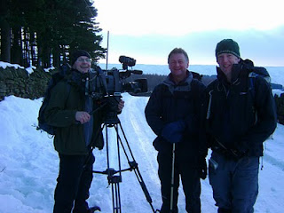
Yesterday, Jon Mitchell (ITV's weatherman) and I went out to Holme in the upper reaches of the Holme Valley, near Huddersfield, to film our latest TV walk for ITV Yorkshire.

We walked a 5-mile route, taking in Brownhill and Marsden reservoirs as well as Cliff Road. It was a picture-perfect Christmas walk with loads of snow on the ground, as well as waist-deep snow drifts as we found out on the moors around Cliff Road. The walk was finished off at the Fleece Inn at Holme (great village pub in the heart of the Yorkshire Pennines), where the local brass band greeted us with Christmas carols.

Tune in either next Thursday (16th Dec) or Friday (17th Dec) on ITV Yorkshire between 6pm and 6:30pm to watch our walk, or log on to our website to watch this clip (after the 17th December) or any of our archived walks www.innway.co.uk/itv-yorkshire-walks-a-breath-of-fresh-air.html