Monday, December 31, 2012

12 inspirational photos of 2012. 

No 3 

Above Ennerdale, Lake District (Mountain Skills course).

March 2012


Saturday, December 29, 2012

12 inspirational photos of 2012. 

No2 Top Mere Road, above Kettlewell, Wharfedale (NNAS Navigation Skills course). 

February 2012.

Friday, December 28, 2012

12 inspirational photos of 2012. 

No1 Mackerel Sky over Tripsdale, North York Moors, Jan 2012.

http://innway.blogspot.co.uk/2012/01/tripsdale-north-york-moors.html

Thursday, December 20, 2012

Christmas Pub Walks 2012

Grassington - Sunday 16th December
Malham - Wednesday 19th December

Great walks, good company and delicious Christmas lunches!

Wishing you all a very merry Christmas and a happy and healthy New Year.

Best wishes, Mark Reid
TeamWalking


Tuesday, December 11, 2012

Pen-y-Ghent walk
11th December 2012

A fantastic, crystal-clear day with a sharp frost

Minus 1 in the valley and minus 4 on the summit, although in the sunshine it was quite warm. Certainly the best day of 2012 for walking, and hardly anyone about.

I was researching and walking the new Three Peaks route across Whitber Hill (thus avoiding the quagmire of Black Dubb Moss) for Country Walking magazine. This new route starts at the top of Horton Scar Lane and heads NW across Whitber Hill, Sell Gill Beck and Sell Gill Hill to join the Pennine Way near Jackdaw Hole. The route is a delight to walk, and easy to follow as it is laid with stone chippings all the way.

A walk across the fells of the Yorkshire Dales on a day like today really lifts your spirits.

Anyway, here's my route:

Horton - Brackenbottom - Pen-y-ghent south ridge - Pen-y-ghent summit - Pennine Way to Horton Scar Lane - new path across Whitber Hill - Pennine Way south along Harber Scar Lane back into Horton.


Tuesday, November 27, 2012

ITV Yorkshire 'Breath of Fresh Air' walks

Watch all 31 ITV 'Breath of Fresh Air' TV walks with Mark Reid and Jon Mitchell 

NOW updated with all 2012 walks, including:
  • Hackfall Woods
  • Wharram Percy
  • Arkengarthdale
  • Lastingham
  • Eyam
  • Whernside
  • Washburn Valley
CL:ICK HERE

Friday, November 23, 2012

Do not follow SAT NAV!

Just ran a 3-day NNAS (Silver award) navigation and hill skills course for Natural England at Grasmere and saw this sign in the village! 

Couldn't agree more... let your brain become the Sat Nav and get skills that will last a lifetime on one of our navigation courses. Don't rely on electronic gadgets to get you across the mountains!

We helped two groups of people who were out without map, compass or torches and didn't know where they were or had to change their route because of swollen streams. One group were up on Blea Rigg at gone 4pm, with only 20 minutes of light left. This frequently happens in the Lake District... and is totally avoidable.

To get the hill skills you need see our website TeamWalking


Monday, November 19, 2012

Randygill Top (624m) - Howgill Fells


To see photos and a description from this walk, click HERE

Friday, October 26, 2012

NetWalking
The inspirational way to grow your business

Networking... but not as you know it!

Walk, talk, think, ideas, refresh, share, enjoy.

  • Friday morning walks throughout Yorkshire, every other month.
  • Like-minded business people
  • Based from great country pubs
  • Join an individual walk OR get annual membership
  • Individual OR company membership
  • ONLY £24 per walk, or £99 per year

MORE INFO


Tuesday, September 18, 2012

Great Knoutberry Hill

Great Knoutberry Hill

20th highest fell in the Yorkshire Dales


See the walk blog here

Thursday, September 06, 2012

ITV Yorkshire walk
Breath of Fresh Air

Went out yesterday with ITV's weatherman Jon Mitchell to film our latest TV walk. The weather was perfect with fantastic visibility. We started from Ribblehead and walked up to the top of Whernside via Blea Moor aqueduct and Force Gill

Tune into ITV Yorkshire next Friday at 6pm to see this walk.


Wednesday, August 15, 2012

Wild Camping mountain expedition - Lake District

Mountain Expedition

Upper Eskdale & Scafell, Lake District

11th & 12th August 2012


A warm, bright and sunny weekend, except for thick mist and 40mph winds on the top of Scafell! We met at the Woolpack Inn at Boot in Eskdale, from where we walked up into Upper Eskdale via Brotherilkeld to Lingcove Bridge from where we headed up into Green Hole below Bow Fell. We then crossed over High Gait Crags and, due to dry streams, dropped down to Upper Eskdale above Great Moss. We then decided to tackle Scafell via Cam Spout and Foxes Tarn, only to have almost zero visibility on the summit, although we soon dropped down below the cloud en route to Slight Side where we had lunch. We then followed the Terrace Path back to Boot.


Tuesday, August 07, 2012

Wild Camping mountain expedition - Lake District

Mountain Expedition


Eskdale & Scafell, Lake District
4th & 5th August 2012

Wild Camping website

We met Saturday morning for a pre-expedition coffee at the brilliant Woolpack Inn at Boot in Eskdale, from where we walked up into Upper Eskdale and the summit of Scafell. The weather was warm and sunny for most of Saturday, but Sunday was different with low cloud and a dramatic thunderstorm.
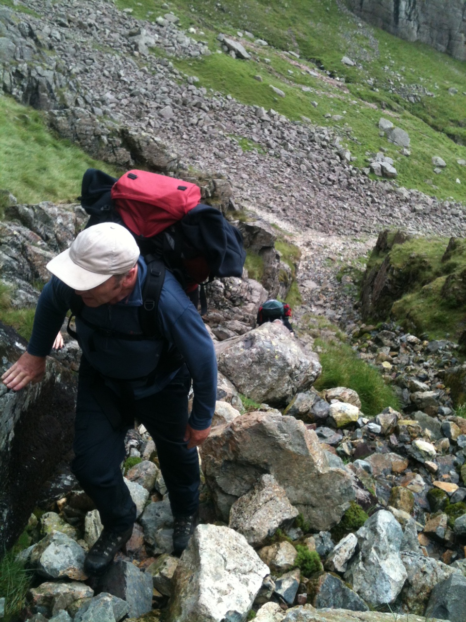
Our route....


Boot, Whahouse Bridge, Taw House, Great Moss, Cam Spout, Foxes Gully, Foxes Tarn and Scafell. As we began our descent towards Slight Side it then went dark, and hail stones soon began to fall. We descended quickly to Slight Side where we sheltered in a gully whilst lightning flashed across the massif, with thunder booming - an unexpected and unforecast thunderstorm! It was exciting but quite daunting to be in the midst of a storm like this, but very memorable. The storm soon cleared and we had some brief sunny spells on the long descent towards Quagrigg Moss before more rain came in. We then followed a narrow, meandering and very wet path to Stony Tarn and Eel Tarn before descending back to the Woolpack for food and beer.


Wednesday, July 11, 2012

Wild Camping expedition - Carneddau, Snowdonia

Mountain Expedition


Carneddau, Snowdonia

7th & 8th July 2012


We stayed over at Betws-y-Coed on Friday evening, then set off to Ogwen Cottage on Saturday morning from where we headed up onto the Carneddau mountains. Despite much of Britain having a very wet weekend, we only had a few spots of rain, with frequent sunny spells.

Our route....


Ogwen Cottage, Llyn Ogwen, Cwm Lloer, Pen yr Ole Wen eastern ridge (scrambling), Pen yr Ole Wen, Carnedd Dafydd, Cefn Ysgolion Duon then down the ridge above Craig Llugwy to Cwm Llugwy. We then headed up onto Carnedd Llewelyn's SE ridge (Penywaun wen), then down the scrambly ridge onto the narrow col of Bwlch Eryl Farchog before heading down to Ffynnon Llgwy and back into the Ogwen valley. Finished with a stop at Capel Curig for lunch at the Bryn Tyrch Inn on our way back to Betws-y-Coed.