Ingleborough & Simon Fell
View photo diary of this walk here:
http://yorkshiredales600s.blogspot.com/2011/01/ingleborough-724m-simon-fell-650m.html
Friday, January 21, 2011
Saturday, January 08, 2011
Ale and Hearty - Pub Walking in Northumberland
Ale and Hearty: Pub walking in Northumberland
The Inn Way... to Northumberland
Featured in today's Guardian (Saturday 8th January 2011)
www.guardian.co.uk/travel/2011/jan/08/walking-pubs-northumberland
" 'It's about appraising your place in the world. Artificial light is not natural, office light is not natural; walking is what we're meant to do." Well-trodden words for sure, but utterly convincing in the salty air – and when spoken by Mark Reid, the man behind the successful Inn Way long-distance walking and pub guides."
Click the link above to read the article
To buy the book, please visit http://www.innway.co.uk/
The Inn Way... to Northumberland
Featured in today's Guardian (Saturday 8th January 2011)
www.guardian.co.uk/travel/2011/jan/08/walking-pubs-northumberland
" 'It's about appraising your place in the world. Artificial light is not natural, office light is not natural; walking is what we're meant to do." Well-trodden words for sure, but utterly convincing in the salty air – and when spoken by Mark Reid, the man behind the successful Inn Way long-distance walking and pub guides."
Click the link above to read the article
To buy the book, please visit http://www.innway.co.uk/
Friday, January 07, 2011
'The Inn Way' Completers
'The Inn Way' Completers List
'The Inn Way' Completers List is now online
Have you walked all 5 routes?
www.innway.co.uk/the-inn-way-walking-books/the-inn-way-completers-list.html
'The Inn Way' Completers List is now online
Have you walked all 5 routes?
www.innway.co.uk/the-inn-way-walking-books/the-inn-way-completers-list.html
Tuesday, January 04, 2011
Northern Echo walk
Northern Echo Walk
Reeth, Apedale, Swaledale
11 miles / 5 hours
Map - OS Explorer OL30
Start / Finish - Reeth, Swaledale
Refreshments - Two moorland shooting huts along the way, and the Buck Hotel at Reeth at the end of the walk.
From Reeth, walked to Grinton then followed the moorland road up across Grinton Moor before cutting off across an area of old lead mines to reach Greets Hill. A moorland track then took us down into secluded Apedale, where we found a superb shooter's hut (Dent's Houses) open for lunch. We then followed the track (bridleway) all the way to the head of the valley (Apedale Head), before dropping down across the flanks fo High Carl (superb views across Swaledale) then down across Harkerside Moor all the way down to the Swing Bridge across the Swale and back up into Reeth.
The name of Apedale is either derived from a Viking personal name 'appi' or from the word for bees. It is certainly away from it all, a valley of stark beauty with disused lead mines and far-reaching views.
Photos (copyright Mark Reid) - the photo-files are named.
Reeth, Apedale, Swaledale
11 miles / 5 hours
Map - OS Explorer OL30
Start / Finish - Reeth, Swaledale
Refreshments - Two moorland shooting huts along the way, and the Buck Hotel at Reeth at the end of the walk.
From Reeth, walked to Grinton then followed the moorland road up across Grinton Moor before cutting off across an area of old lead mines to reach Greets Hill. A moorland track then took us down into secluded Apedale, where we found a superb shooter's hut (Dent's Houses) open for lunch. We then followed the track (bridleway) all the way to the head of the valley (Apedale Head), before dropping down across the flanks fo High Carl (superb views across Swaledale) then down across Harkerside Moor all the way down to the Swing Bridge across the Swale and back up into Reeth.
The name of Apedale is either derived from a Viking personal name 'appi' or from the word for bees. It is certainly away from it all, a valley of stark beauty with disused lead mines and far-reaching views.
Photos (copyright Mark Reid) - the photo-files are named.
Friday, December 31, 2010
New Year resolution - Get fit in the Great Outdoors
Is your 2011 New Year's Resolution to get fit and healthy?
Head out to the 'green gym' this New Year!
Do you want to...?
There is nothing better than a long walk in Britain's beautiful countryside - you not only burn off calories (up to 400 an hour!), but you also give your body a total workout - physically, mentally and spiritually; walking in the Great Outdoors is simply great for your mind, body and soul.
But do you have the skills to plan your own walks and then navigate safely (using a map and compass)?
We offer 1 & 2-day Navigation Skills Courses in the Yorkshire Dales, North York Moors and Peak District throughout 2011, including National Navigation Award Scheme (NNAS) Bronze, Silver and Gold levels. Gain a national award!
Explore further and step out with confidence in 2011!
2-day NNAS courses: www.teamwalking.co.uk/navigation_skills_weekends.html
1-day courses & Outdoor Experiences: www.teamwalking.co.uk/outdoorexperiences.html
ONLY £99 per person for our 2-day courses or £49 for our 1-day courses.
Head out to the 'green gym' this New Year!
Do you want to...?
- Get fit and healthy in 2011
- Maintain your new physical activity regime
- Learn new skills that will last a lifetime
- Enjoy exercise in a sociable way
- Be surrounded by inspirational landscapes and greenery
- Save money on expensive gym memberships
There is nothing better than a long walk in Britain's beautiful countryside - you not only burn off calories (up to 400 an hour!), but you also give your body a total workout - physically, mentally and spiritually; walking in the Great Outdoors is simply great for your mind, body and soul. But do you have the skills to plan your own walks and then navigate safely (using a map and compass)?
We offer 1 & 2-day Navigation Skills Courses in the Yorkshire Dales, North York Moors and Peak District throughout 2011, including National Navigation Award Scheme (NNAS) Bronze, Silver and Gold levels. Gain a national award!
Explore further and step out with confidence in 2011!
2-day NNAS courses: www.teamwalking.co.uk/navigation_skills_weekends.html
1-day courses & Outdoor Experiences: www.teamwalking.co.uk/outdoorexperiences.html
ONLY £99 per person for our 2-day courses or £49 for our 1-day courses.
Wednesday, December 22, 2010
Northern Echo Christmas walk - Ingleby Greenhow
Northern Echo Walk - Christmas 2010
Ingleby Greenhow, North York Moors.
4 miles / 2 hours.
OS Explorer Map OL26
Start/Finish - Ingleby Greenhow, near Great Ayton, North Yorkshire
Refreshments - Dudley Arms, Ingleby Greenhow
Ingleby Greenhow is a delightful village that lies just within the boundary of the North York Moors National Park. It is dominated by the great arc of the Cleveland Hills that sweep round in sinuous curves to the east and south of the village, sheltering it from easterly winds. The name of the village may be derived from the Danish words ‘Ingleby’ meaning ‘village of the English’ and Greenhow meaning ‘green hill’ – it is certainly surrounded by green hills, although the day I walked this route everything was completely white with snow. On the edge of the village stands St Andrews Church, a beautiful low, stone building that dates back to the 12th Century when it belonged to the monks of Whitby Abbey, although a church may have stood on this site in Saxon times. It was largely rebuilt in 1741.
This walk heads into the deep recess known as Greenhow Bottom that cuts into the Cleveland Hills creating an impressive amphitheatre of hills around a basin of fields and a scattering of farms that rarely see sunlight in the winter months. Field paths and quite lanes lead into Greenhow Bottom before a path drops down over a footbridge across Ingleby Beck then up to join a track along the foot of the steep escarpment of Ingleby Bank. Remarkably, this track was once a railway line that was built in 1861 by the North Eastern Railway Company to transport ironstone from Rosedale in the heart of the North York Moors to Teesside. This amazing feat of engineering followed the contours of the hills perfectly for eleven miles from the moors above Rosedale, around the head of Farndale to Incline Top above Ingleby Greenhow from where loaded goods wagons were lowered down a 1-in-5 incline from the escarpment of the Cleveland Hills to join the main line at Battersby Junction. At its height during the 1870s over 300,000 tons of iron ore was transported by rail to Teesside annually, peaking at over 560,000 tons in 1873. The mines closed following the General Strike of 1926 and three years later the last train was lowered down the Incline. Our route joins this old railway about a kilometre north of the foot of the Incline and then follows the track-bed for almost two kilometres to reach Bank Foot. Bank Foot was once an important location along the ancient highway between Kirkbymoorside and the villages of Cleveland via the moorland ridge of Rudland Rigg; above these farms this old ‘Coach Road’ winds steeply up Ingleby Bank onto the Cleveland Hills from where it headed south across Rudland Rigg.
For route details, visit the following website between the 23rd and 30th December 2010 (as the website is updated with a new walk every week) http://www.thenorthernecho.co.uk/leisure/mindbodysoul/walks/
Photos (copyright Mark Reid) - the photo-files are named.
Ingleby Greenhow, North York Moors.
4 miles / 2 hours.
OS Explorer Map OL26
Start/Finish - Ingleby Greenhow, near Great Ayton, North Yorkshire
Refreshments - Dudley Arms, Ingleby Greenhow
Ingleby Greenhow is a delightful village that lies just within the boundary of the North York Moors National Park. It is dominated by the great arc of the Cleveland Hills that sweep round in sinuous curves to the east and south of the village, sheltering it from easterly winds. The name of the village may be derived from the Danish words ‘Ingleby’ meaning ‘village of the English’ and Greenhow meaning ‘green hill’ – it is certainly surrounded by green hills, although the day I walked this route everything was completely white with snow. On the edge of the village stands St Andrews Church, a beautiful low, stone building that dates back to the 12th Century when it belonged to the monks of Whitby Abbey, although a church may have stood on this site in Saxon times. It was largely rebuilt in 1741.
This walk heads into the deep recess known as Greenhow Bottom that cuts into the Cleveland Hills creating an impressive amphitheatre of hills around a basin of fields and a scattering of farms that rarely see sunlight in the winter months. Field paths and quite lanes lead into Greenhow Bottom before a path drops down over a footbridge across Ingleby Beck then up to join a track along the foot of the steep escarpment of Ingleby Bank. Remarkably, this track was once a railway line that was built in 1861 by the North Eastern Railway Company to transport ironstone from Rosedale in the heart of the North York Moors to Teesside. This amazing feat of engineering followed the contours of the hills perfectly for eleven miles from the moors above Rosedale, around the head of Farndale to Incline Top above Ingleby Greenhow from where loaded goods wagons were lowered down a 1-in-5 incline from the escarpment of the Cleveland Hills to join the main line at Battersby Junction. At its height during the 1870s over 300,000 tons of iron ore was transported by rail to Teesside annually, peaking at over 560,000 tons in 1873. The mines closed following the General Strike of 1926 and three years later the last train was lowered down the Incline. Our route joins this old railway about a kilometre north of the foot of the Incline and then follows the track-bed for almost two kilometres to reach Bank Foot. Bank Foot was once an important location along the ancient highway between Kirkbymoorside and the villages of Cleveland via the moorland ridge of Rudland Rigg; above these farms this old ‘Coach Road’ winds steeply up Ingleby Bank onto the Cleveland Hills from where it headed south across Rudland Rigg.
For route details, visit the following website between the 23rd and 30th December 2010 (as the website is updated with a new walk every week) http://www.thenorthernecho.co.uk/leisure/mindbodysoul/walks/
Photos (copyright Mark Reid) - the photo-files are named.
Friday, December 10, 2010
ITV YORKSHIRE TV WALK - Holme Valley
ITV YORKSHIRE TV WALK
Holme Valley - Christmas 2010
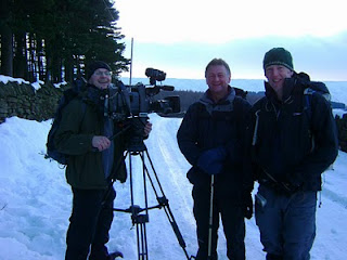
Yesterday, Jon Mitchell (ITV's weatherman) and I went out to Holme in the upper reaches of the Holme Valley, near Huddersfield, to film our latest TV walk for ITV Yorkshire.
We walked a 5-mile route, taking in Brownhill and Marsden reservoirs as well as Cliff Road. It was a picture-perfect Christmas walk with loads of snow on the ground, as well as waist-deep snow drifts as we found out on the moors around Cliff Road. The walk was finished off at the Fleece Inn at Holme (great village pub in the heart of the Yorkshire Pennines), where the local brass band greeted us with Christmas carols.
Tune in either next Thursday (16th Dec) or Friday (17th Dec) on ITV Yorkshire between 6pm and 6:30pm to watch our walk, or log on to our website to watch this clip (after the 17th December) or any of our archived walks www.innway.co.uk/itv-yorkshire-walks-a-breath-of-fresh-air.html


Holme Valley - Christmas 2010
Yesterday, Jon Mitchell (ITV's weatherman) and I went out to Holme in the upper reaches of the Holme Valley, near Huddersfield, to film our latest TV walk for ITV Yorkshire.
We walked a 5-mile route, taking in Brownhill and Marsden reservoirs as well as Cliff Road. It was a picture-perfect Christmas walk with loads of snow on the ground, as well as waist-deep snow drifts as we found out on the moors around Cliff Road. The walk was finished off at the Fleece Inn at Holme (great village pub in the heart of the Yorkshire Pennines), where the local brass band greeted us with Christmas carols.
Tune in either next Thursday (16th Dec) or Friday (17th Dec) on ITV Yorkshire between 6pm and 6:30pm to watch our walk, or log on to our website to watch this clip (after the 17th December) or any of our archived walks www.innway.co.uk/itv-yorkshire-walks-a-breath-of-fresh-air.html
Wednesday, December 08, 2010
Outdoors Show, Excel, London, 13 - 16 Jan 2011
TeamWalking goes to the Outdoors Show
TeamWalking offers:
www.teamwalking.co.uk
We will be on the Welcome to Yorkshire stand.
TeamWalking offers:
- 2-day Navigation Skills courses (NNAS)
- 1-day introduction to map & compass courses
- Compass skills days (open access walking)
- Night navigation experiences
- 'The Inn Way' 2-day walking experience
- Corporate team building and team bonding days
- Corporate activity days in the Great Outdoors
www.teamwalking.co.uk
Friday, November 26, 2010
navigation skills course - Grassington
Navigation Skills course - Grassington, Yorkshire Dales
NNAS Bronze award
2-days walking in Wharfedale, based at the Devonshire Hotel, Grassington.
The course includes:
Gain a national navigation award!
www.teamwalking.co.uk/navigation_skills_weekends.html
NNAS Bronze award
2-days walking in Wharfedale, based at the Devonshire Hotel, Grassington.
The course includes:
- route planning
- weather forecasts
- map skills
- navigation skills
- compass skills
- relocation
- gear & equipment
- food and water
- emergency procedures
Gain a national navigation award!
www.teamwalking.co.uk/navigation_skills_weekends.html
Friday, November 12, 2010
Northern Echo Walk - Shacklesborough
Northern Echo Walk
Shacklesborough, Baldersdale, North Pennines
4.75 miles / 3 hours.
Open Access Land (no dogs) - OS Explorer Map OL31
Cotherstone Moor is a vast expanse of predominantly grassy moorland, punctuated by small, rocky and very distinctive flat-topped hills, of which Shacklesborough is the most dramatic. This moorland rises up to the south of Baldersdale, and forms part of a much larger stretch of moorland that separates this tributary of Teesdale from Stainmore to the south; it is a wide, wild and windswept place! From Balderhead Reservoir, a stony track leads up to Water Knott (outdoor centre), from where a grassy quad bike track takes you across grassy moorland (Open Access Land) to the foot of the steep slopes of Shacklesborough via Galloway Rigg and a sheepfold. It is then a short, sharp and rocky climb to the top with its Trig Point and large cairn, from where there is a magnificent panorama across the North Pennines. From the Trig Point and cairn on this flat-topped tor of more resistant gritstone there are far-reaching views across the hills of the northern Yorkshire Dales, North Pennines and, on a clear day, the Lakeland mountains and the North York Moors on the horizon. This is a wonderful spot, a place to sit awhile and take in the wonderful views. In fact, Shacklesborough is a hill that I have wanted to climb for many years, and it did not disappoint.
There are two ways back from the top; either re-trace your steps along the quad bike track or strike north across the boggy tussock grass to pick up some small streams and quad bike tracks that take you back to Water Knott via Low Round Sheepfold and Gill Sike, albeit with wet feet and trousers! A memorable walk in the North Pennines.
Photos (copyright Mark Reid)
Shacklesborough, Baldersdale, North Pennines
4.75 miles / 3 hours.
Open Access Land (no dogs) - OS Explorer Map OL31
Cotherstone Moor is a vast expanse of predominantly grassy moorland, punctuated by small, rocky and very distinctive flat-topped hills, of which Shacklesborough is the most dramatic. This moorland rises up to the south of Baldersdale, and forms part of a much larger stretch of moorland that separates this tributary of Teesdale from Stainmore to the south; it is a wide, wild and windswept place! From Balderhead Reservoir, a stony track leads up to Water Knott (outdoor centre), from where a grassy quad bike track takes you across grassy moorland (Open Access Land) to the foot of the steep slopes of Shacklesborough via Galloway Rigg and a sheepfold. It is then a short, sharp and rocky climb to the top with its Trig Point and large cairn, from where there is a magnificent panorama across the North Pennines. From the Trig Point and cairn on this flat-topped tor of more resistant gritstone there are far-reaching views across the hills of the northern Yorkshire Dales, North Pennines and, on a clear day, the Lakeland mountains and the North York Moors on the horizon. This is a wonderful spot, a place to sit awhile and take in the wonderful views. In fact, Shacklesborough is a hill that I have wanted to climb for many years, and it did not disappoint.
There are two ways back from the top; either re-trace your steps along the quad bike track or strike north across the boggy tussock grass to pick up some small streams and quad bike tracks that take you back to Water Knott via Low Round Sheepfold and Gill Sike, albeit with wet feet and trousers! A memorable walk in the North Pennines.
Photos (copyright Mark Reid)
Thursday, November 04, 2010
Add years to your life and life to your years
ADD YEARS TO YOUR LIFE, AND LIFE TO YOUR YEARS
Yesterday, I took a group of 10 business professionals out NetWalking in the Yorkshire Dales.
NetWalking is a unique networking concept that provides uninterrupted “talk time” whilst surrounded by inspirational landscapes.
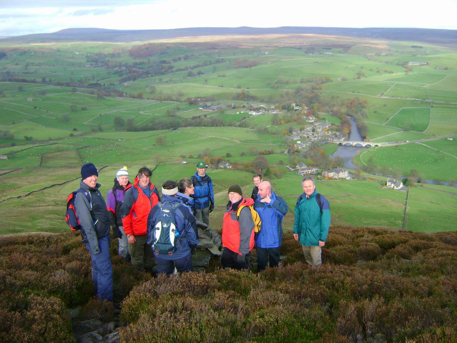
After breakfast at the Red Lion at Burnsall, we set off across fields and pastures to the hidden village of Thorpe from where a track took us to the top of Barden Fell, a wonderful expanse of heather moorland. After a snack at a shooters' hut, we walked to a ciarn high above Burnsall from where there were spectacular views before heading back down to the Red Lion for lunch.
The main purpose of the day was to get to know like-minded business professionals in an informal yet highly effective way, where you can build strong relationships during a 3-hour walk through the beautiful Yorkshire Dales.
So, if you are a business professional that wants to meet some great people, clear your mind and get some good exercise, NetWalking is for you.
http://www.netwalkinguk.com/
Read what others say about NetWalking
www.inntravel.co.uk/Blog/September-2010/Netwalking.aspx
catapultcreativeblog.co.uk/?p=370
Yesterday, I took a group of 10 business professionals out NetWalking in the Yorkshire Dales.
NetWalking is a unique networking concept that provides uninterrupted “talk time” whilst surrounded by inspirational landscapes.
After breakfast at the Red Lion at Burnsall, we set off across fields and pastures to the hidden village of Thorpe from where a track took us to the top of Barden Fell, a wonderful expanse of heather moorland. After a snack at a shooters' hut, we walked to a ciarn high above Burnsall from where there were spectacular views before heading back down to the Red Lion for lunch.
The main purpose of the day was to get to know like-minded business professionals in an informal yet highly effective way, where you can build strong relationships during a 3-hour walk through the beautiful Yorkshire Dales.
So, if you are a business professional that wants to meet some great people, clear your mind and get some good exercise, NetWalking is for you.
http://www.netwalkinguk.com/
Read what others say about NetWalking
www.inntravel.co.uk/Blog/September-2010/Netwalking.aspx
catapultcreativeblog.co.uk/?p=370
Friday, October 22, 2010
ITV YORKSHIRE WALKS - HAWORTH
My latest ITV walk with weatherman Jon Mitchell is now online.
This month, we head up onto the moors above Haworth in search of Wuthering Heights.
www.innway.co.uk/itv-yorkshire-walks-a-breath-of-fresh-air.html
My latest ITV walk with weatherman Jon Mitchell is now online.
This month, we head up onto the moors above Haworth in search of Wuthering Heights.
www.innway.co.uk/itv-yorkshire-walks-a-breath-of-fresh-air.html
Tuesday, October 19, 2010
Great Whernside (704m)
Great Whernside - 704 metres
See photo diary here http://yorkshiredales600s.blogspot.com/2010/10/great-whernside-704m.html
Tuesday, October 12, 2010
Mountain Leader Training - Plas y Brenin
Spent last week at Plas y Brenin (National Mountain Centre) in Snowdonia where I completed the Mountain Leader (summer) training course. Superb venue, magnificent mountains, great food/accommodation and very knowledgeable and experienced instructors. I learnt a great deal, which I'll now put into practice before going back to Plas y Brenin for my ML assessment in spring next year.
PIC: View from Moel Siabod
PIC: Moelwyns

PIC: Cnicht summit
4th - 8th October 2010
Spent last week at Plas y Brenin (National Mountain Centre) in Snowdonia where I completed the Mountain Leader (summer) training course. Superb venue, magnificent mountains, great food/accommodation and very knowledgeable and experienced instructors. I learnt a great deal, which I'll now put into practice before going back to Plas y Brenin for my ML assessment in spring next year.
Mountain days included: Moel Siabod, Glyder Fawr (via Y Gribin) and a 2-day expedition and wild camp across the Moelwyns.
PIC: Y Gribin & Tryfan from Glyder Fawr
PIC: View from Moel Siabod
PIC: Moelwyns wild camp
PIC: Moelwyns
PIC: Cnicht summit
Friday, October 01, 2010
The Inn Way to the English Lake District
NEW 2nd Edition due out in late autumn 2010
Completely updated, re-walked and revised, this new edition features more information, text and revised route descriptions (with Grid References) as well as an 8-page colour photograph section and a new cover, re-branded as The Ultimate Pub Walks.
Publication date: late autumn 2010
RRP £10:95
NEW 2nd Edition due out in late autumn 2010
Completely updated, re-walked and revised, this new edition features more information, text and revised route descriptions (with Grid References) as well as an 8-page colour photograph section and a new cover, re-branded as The Ultimate Pub Walks.
Publication date: late autumn 2010
RRP £10:95
Wednesday, September 22, 2010
Christmas Pub Walk & Lunch
with Mark Reid, author of 'The Inn Way' guidebooks
Just imagine it... a crisp December morning, a wonderful winter walk in the Yorkshire Dales, mince pies on the hillside, crackling log fire and a 2-course Christmas lunch at the Devonshire Hotel, Grassington.
WEDNESDAY 15th DECEMBER 2010
ONLY £39 per person
To book your place: www.innwayshop.co.uk/acatalog/Christmas_Pub_Walk___Lunch.html
with Mark Reid, author of 'The Inn Way' guidebooks
Just imagine it... a crisp December morning, a wonderful winter walk in the Yorkshire Dales, mince pies on the hillside, crackling log fire and a 2-course Christmas lunch at the Devonshire Hotel, Grassington.
WEDNESDAY 15th DECEMBER 2010
- Welcome tea & coffee (9am)
- Leisurely, enjoyable and informative guided walk with Mark Reid (9:30am - 1pm)
- Mince pie break on the hillside
- 2-course Christmas lunch - turkey & all the trimmings and Christmas pudding (1pm - 2pm)
- Use of our Berghaus gear if required.
ONLY £39 per person
To book your place: www.innwayshop.co.uk/acatalog/Christmas_Pub_Walk___Lunch.html
Monday, September 20, 2010
ITV Yorkshire Walks
ITV YORKSHIRE WALKS
My two latest ITV Yorkshire walks with Jon Mitchell (ITV's weatherman) are now available on my website
Todmorden & Stoodley Pike
Castleton & Mam Tor
http://www.innway.co.uk/itv-yorkshire-walks-a-breath-of-fresh-air.html
My two latest ITV Yorkshire walks with Jon Mitchell (ITV's weatherman) are now available on my website
Todmorden & Stoodley Pike
Castleton & Mam Tor
http://www.innway.co.uk/itv-yorkshire-walks-a-breath-of-fresh-air.html
Tuesday, September 14, 2010
Boots and Beer Walking Festival
Boots and Beer Walking Festival 2010
Pic: Looking across to Hawes from Sedbusk
Another great Walking Festival last weekend. Over 430 walkers came up to Wensleydale to enjoy a weekend of great walks, classic pubs and evening entertainment.
After a very wet Friday, the weather improved with sunshine and squally showers. There were 14 self-guided walks to choose from, varing from 4 to 15 miles in length, and everyone who set off came back safely having had a great time. But there again, you can not help but be impressed by the stunning landscapes of the Yorkshire Dales. We also raised over £800 for Swaledale Mountain Rescue Team, who were on standby over the weekend (but thankfully were not called upon!).
I researched and wrote all of the walks - over 120 miles of paths - which took me the best part of the summer.
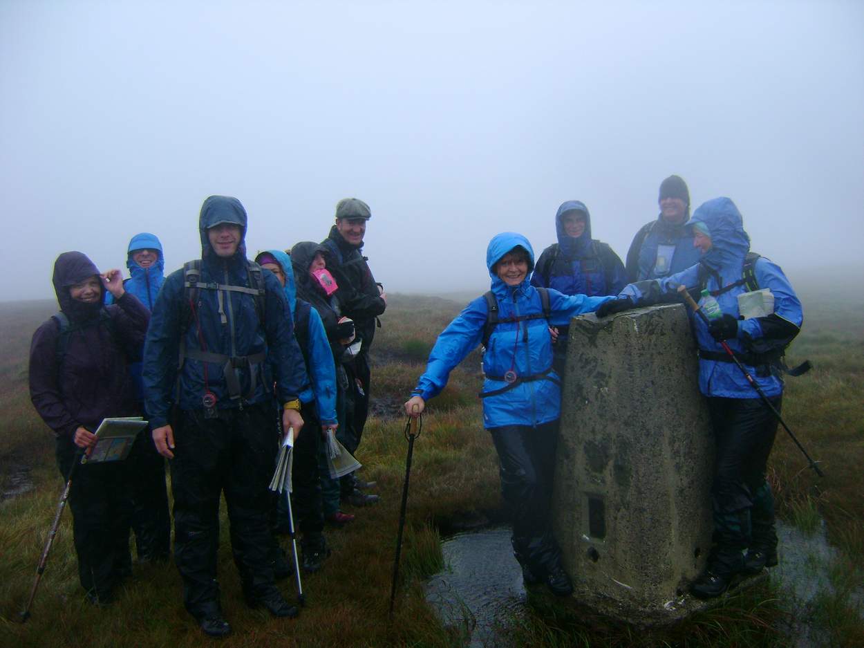
On Friday I took an Open Access navigation skills walk up to the summit of Dodd Fell (668m), which was challenging due to the weather and terrain, but hugely enjoyable.
Here's a photo of us on the summit
Pic: Summit of Dodd Fell (668 metres)
I hope to see you at next year's event, which will be our 10th Walking Festival http://www.bootsandbeer.com/
Cheers
Mark Reid
Pic: Looking across to Hawes from Sedbusk
Another great Walking Festival last weekend. Over 430 walkers came up to Wensleydale to enjoy a weekend of great walks, classic pubs and evening entertainment.
After a very wet Friday, the weather improved with sunshine and squally showers. There were 14 self-guided walks to choose from, varing from 4 to 15 miles in length, and everyone who set off came back safely having had a great time. But there again, you can not help but be impressed by the stunning landscapes of the Yorkshire Dales. We also raised over £800 for Swaledale Mountain Rescue Team, who were on standby over the weekend (but thankfully were not called upon!).
I researched and wrote all of the walks - over 120 miles of paths - which took me the best part of the summer.
On Friday I took an Open Access navigation skills walk up to the summit of Dodd Fell (668m), which was challenging due to the weather and terrain, but hugely enjoyable.
Here's a photo of us on the summit
Pic: Summit of Dodd Fell (668 metres)
I hope to see you at next year's event, which will be our 10th Walking Festival http://www.bootsandbeer.com/
Cheers
Mark Reid
Thursday, September 02, 2010
NetWalking
NetWalking - 01/09/10
Inn at Hawnby, North York Moors
Spent yesterday morning with a group of business professionals in the North York Moors. Had breakfast at the Inn at Hawnby, then went for a 6 mile walk across the heather moors and finished back at the pub for lunch. There was time to talk, think and network with like-minded people. Just started a NetWalking group on LinkedIn as well, which will help everyone keep in touch.
For more information http://www.netwalkinguk.com/
Inn at Hawnby, North York Moors
Spent yesterday morning with a group of business professionals in the North York Moors. Had breakfast at the Inn at Hawnby, then went for a 6 mile walk across the heather moors and finished back at the pub for lunch. There was time to talk, think and network with like-minded people. Just started a NetWalking group on LinkedIn as well, which will help everyone keep in touch.
For more information http://www.netwalkinguk.com/
Subscribe to:
Posts (Atom)