Friday, July 01, 2011

'The Inn Way' walking experience - June 2011

'The Inn Way' walking experience

 A historical journey of exploration in the Yorkshire Dales
23rd & 24th June 2011

In late June, I guided a wonderful group of people along Stages 3 & 4 of 'The Inn Way... to the Yorkshire Dales'

DAY ONE
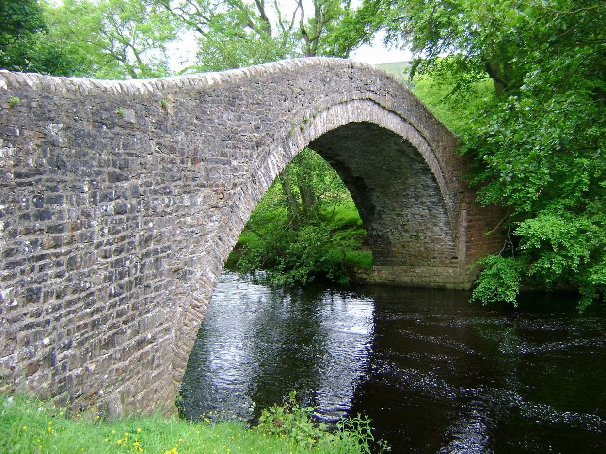
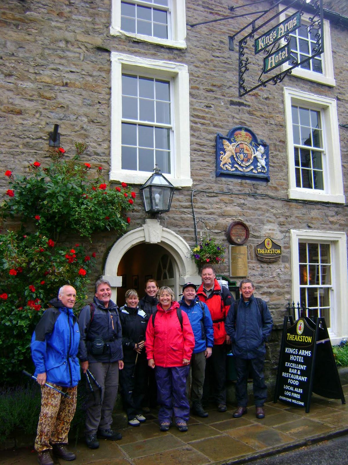
From the Kings Arms at Askrigg, we climbed up onto Askrigg Moor before dropping down through Oxnop Ghyll to Ivelet Bridge, where we looked at the old coffin stone and talked about the legends associated with this ancient packhorse bridge. The haymeadows were in full bloom as we walked across fields to Gunnerside and lunch at the Kings Head (superb food). The afternoon saw us walk across more meadows, then past a spectacular waterfall along Haverdale Beck before climbing up onto Harkerside, with beautiful retrospective views across Swaledale. The final section of the walk took us alongside the Swale to Grinton, where we stayed at the Bridge Inn - great food and beer! The day's weather was a mixture of sharp showers and sunny spells.

DAY TWO
From Grinton, we climbed up across Grinton Moor, through old lead mines to reach Greets Hill, from where a track took us into hidden Apedale and the shooters' hut at Dent's Houses (complete with visitor's book). The sun was now shining so we did some barefoot walking across the moors. A slight incline took us up onto Black Hill and then a long descent, with wonderful views across Wensleydale, to the incredible fortress of Bolton Castle. After refreshements, delightful field paths took us to Carperby (Wheatsheaf Inn) and then along Oxclose Road (the old road through Wensleydale) to Woodhall and Worton, where we had a final drink at the legendary Victoria Arms before crossing a couple of fields back to Askrigg. A wonderful day of warm sunshine.

We walked around 14 miles each day and managed to visit five pubs.

Thanks to Mark, Tony, Marie, Linda, Terry, Tony, Brian and Jo for joining me on this walk.

Why not book onto our next guided walk in the Lake District?
'The Inn Way' walking experience
15th & 16th September 2011

A historical journey of exploration in the Lake District
www.teamwalking.co.uk/inn-way-walking-experience.html

ALL PHOTOGRAPHS COPYRIGHT MARK REID 2011


Monday, June 13, 2011

Canadian Gold Medal Plates

An Olympic Gold Medal Winner, a Comedian & 40 Canadians visit the Yorkshire Dales

Mark Reid ('The Inn Way' author & Mountain Leader) and Richard Tarran (Expedition & Mountain Leader) hosted 40 Canadian guests for a week's hill-walking throughout the Yorkshire Dales at the beginning of June.

The Canadians had bid for this trip at special gala dinners throughout Canada last autumn to support their Olympic athletes. Accompanying them was well-known Canadian comedian Ron James and 2010 Winter Olympics Men's skeleton Gold Medal winner Jon Montgomery.

We had a fantastic week of great walks, food, accommodation, beer and laughter. We stayed for three nights at the CB Inn (Arkengarthdale) and three nights at Simonstone Hall, and walked around Muker, Reeth, Great Shunner Fell and Askrigg. We also visited several pubs to sample some local ales...

TeamWalking
Would you like us to organise a bespoke walking event for you, your friends or your company? We know the paths and pubs of the Yorkshire Dales, Lake District, Peak District and North York Moors like the back of our hands! Visit http://www.teamwalking.co.uk/ for more information

Farmers Arms, Muker


Fremington Edge, Arkengarthdale

 
Mark Reid (L) with Jon Montgomery (R)


Red Lion, Langthwaite


Muker, Swaledale


Roman Road, Wensleydale 


Crackpot Hall, Upper Swaledale  


Tuesday, June 07, 2011

Mark Reid - ITV 'The Dales'

Mark Reid, author of The Inn Way, featured on ITV's The Dales on Monday 6th June.


Mark Reid, 'The Inn Way' author and Mountain Leader, met Jackie Stubbs, landlady of the George & Dragon pub at Hudswell, last summer and then took Jackie's mum Margaret for a day's walk from the pub to Richmond and back. We enjoyed lunch sat beside the river beneath the castle ramparts at Richmond, and then walked back along the riverside path through Hudswell Woods before climbing the infamous steps back up to the village!

This walk was screened on ITV1 on the 6th June. ITV 'The Dales' website

Read about it in Country Walking magazine (May 2011)

Visit Mark Reid's website The Inn Way

Saturday, June 04, 2011

Financial Times Travel Feature

The Inn Way... to the English Lake District

Financial Times

1-page travel feature - Saturday 4th June 2011

"I stumbled lonely as a cloud"

Read Tim Moore's feature about walking Stages 1 & 2 of 'The Inn Way' here: Financial Times website


WALK THIS ROUTE WITH MARK REID
15th / 16th September 2011
Ambleside - Rosthwaite - Braithwaite

2-day guided walk with Mark Reid along Stage 1 & 2 of 'The Inn Way' (as featured in the Financial Times).


Includes:

  • 2-days guided walk with Mark Reid (Mountain Leader)
  • Tea/coffee when we meet on Monday morning
  • Signed copy of 'The Inn Way... to the English Lake District'
  • Bus transfer back to Ambleside at the end of the walk
  • Use of our Berghaus gear, if required
 Numbers strictly limited to 12, over 18s only.

BOOK NOW

Sunday, May 29, 2011

ITV Yorkshire Walks - Breath of Fresh Air

ITV Yorkshire Walks - Breath of Fresh Air
Roseberry Topping

Recently filmed my latest walk for ITV Yorkshire with weatherman Jon Mitchell, which should be screened on Friday 3rd June on ITV Yorkshire's 'Calendar' programme.

We did a superb 6-mile walk from Great Ayton that took in Aireyholme Farm (where Capt Cook grew up), Roseberry Topping and Easby Moor. The weather was superb with great visibility, although very windy.

This is the 21st walk that we have done over the last 3 years in the Yorkshire region. To watch these TV walks, please visit http://www.innway.co.uk/itv-yorkshire-walks-a-breath-of-fresh-air.html

Here's some photos from our walk...


Saturday, May 28, 2011

The Inn Way - 2 day walk

The Inn Way
2-day walk with Mark Reid
23rd & 24th June 2011

Join Mark Reid for a 2-day walk through Wensleydale and Swaledale, along Stages 3 and 4 of The Inn Way... to the Yorkshire Dales. 


  • Spend 2 days walking through the Yorkshire Dales with Mark Reid
  • Enjoy relaxed pub lunches at traditional Dales inns
  • Visit unspoilt Dales pubs
  • Enjoy a game of quoits on the village green
  • Explore Bolton Castle
  • Stay overnight at Grinton in Swaledale
ONLY £79 PER PERSON

Price includes:
  • 2-days guided walk with Mark Reid
  • Baggage transfers
  • Signed copy of 'The Inn Way'
  • Tea/coffee when we meet
  • Game of Quoits on the village green
  • 10% discount off accommodation at Bridge Inn, Grinton (double/twin room)

For further information: http://www.teamwalking.co.uk/inn-way-walking-experience.html

Limited availability. Over 18s only.

Wednesday, May 18, 2011

Mountain Leader assessment - Plas y Brenin

Mountain Leader assessment - Plas y Brenin
9th - 13th May 2011

Spent last week at Plas y Brenin (National Mountain Centre) in Snowdonia where I successfully completed my Mountain Leader (summer) assessment.

PYB is a great venue, with top instructors. The week was quite challenging, both physically and mentally, as you had to not only think about group management, the environment, navigation and steep ground but also had to always know precisely where you were on the map.

Monday - micro navigation day on Moel Siabod
Tuesday - steep ground day on the North Ridge of Tryfan
Wednesday to Friday - 3 day expedition on Snowdon, with 2 nights wild camping, as well as emergency ropework.

The weather was a mixture of blustery showers, low cloud and the occasional hail storm.

If you are looking for a guided mountain walk, 2-day wild camping expedition or a corporate team building day in the hills or mountains then get in touch http://www.teamwalking.co.uk/


Saturday, May 14, 2011

The Inn Way... to the English Lake District

The Inn Way...to the English Lake District

NEW 2nd Edition OUT NOW
Completely updated, re-walked and revised, this new edition features more information, text and revised route descriptions (with Grid References) as well as an 8-page colour photograph section.

BUY NOW

This book will soon be featured in the Financial Times... watch this space!

Wednesday, April 13, 2011

West Coast of Ireland, 8th - 11th April 2011

Connemara, West Coast of Ireland
8th - 11th April 2011

Two days of walking with seven friends: me (Mark), Giles, Chris, Tony, Luke, Nick, Dean and Stuart. A weekend of mountains walks during the day, and Guinness at Matt Molloys bar, Westport in the evening. Perfect.

Glencoaghan Horseshoe, Twelve Bens, Connemara
Challenging walk in the heart of the Twelve Bens mountain range, taking in five peaks including Derryclare, Bencorr (711m), Bencollaghduff (696m), Maumina (563m) and Benbreen (691m). The walk took us almost 8 hours to complete. Although only about 10km in distance, the walk included around 1,500m of ascent. The entire day was spent either climbing up or down rocky mountains, as there are very few flat sections along this walk. The main challenge was steep ground, with several very steep scree runs or rocky scrambles to negotiate. There was also one narrow and steep ridge to descend from Bencollaghduff, as well as a long and steep scree run from Benbreen. We then turned east from the col between Benbreen and Bengower back into Glencoaghan. A superb mountain day. Map and compass essential to ensure the correct line of ascent/descent as the walk is pathless in places and the route is bounded by some serious cliffs.

Glenlaur Horseshoe, Sheeffry Hill, County Mayo
A gentler walk (relatively speaking!) up onto the broad ridge of the Sheeffry Hills in Co Mayo. Parked near Sheeffry Bridge and then walked up into Glenlaur before striking south up onto the col on the southern arm of the horseshoe. Two quite steep climbs then ensued, with a long, flat and quite narrow ridge in between, up onto the broad summit plateau. This plateau is dissected by small streams, ponds and peat hags that was reminiscent of Kinder Scout. No paths whatsoever, so a compass bearing was essential to hit the small cairn that marks the 742m spot height. And what a view from this cairn, with Croagh Patrick and Clew Bay in the distance. From the summit, headed east to reach the brow of the steep and fairly narrow ridge that leads down into a narrow col on its northern arm. Then continued over a slight rise of land before a long and steep descent topick up a stream that took us back into Glenlaur. A total contrast from yesterday's walk - grassy/boggy underfoot, only one major climb and navigationally slightly more difficult because of the sprawling summit plateau.

Photographs copyright Giles Rocholl Photography http://www.gilesrocholl.com

GLENCOAGHAN HORSESHOE


GLENLAUR HORSESHOE


Photographs copyright Giles Rocholl Photography http://www.gilesrocholl.com

Thursday, March 31, 2011

Snowdonia Wild Camp

2-day Mountain Expedition - Snowdonia, March 2011

Cwm Eigiau Horseshoe, Carneddau


2-day mountain expedition around the Cwm Eigiau Horseshoe.

Route - set off lunchtime Monday; returned lunchtime Tuesday. 2 people (me & Nick).

DAY ONE - Cwm Eigiau car park (SH 732 663). Track to Cedryn, then ascended by old quarry workings onto Pen Llithrig Y Wrach, then followed ridge onto Pen Yr Helgi Du. Wild camped on summit of Pen Yr Helgi Du (830 metres). Warm during day, cold at night. Reasonable visibility, light winds. Rain shower at 5am.

DAY TWO - Bwlch Eryi Farchog (narrow and steep ridge, with some scrambling), Penywaun-Wen, Carnedd Llewelyn (1064 metres) then down into the saddle of Gwaun y Garnedd before striking eastwards across the broad plateau to reach the steep ground above Melynllyn (reservoir). Continued NE across the broad ridge skirting above the crags/outcrops above Llyn Eigiau before descending towards Cerrig Cochlon and back to the parking area.

This is spectacular route through remote mountains with a variety of terrain including moorland, mountain plateau, several mountain summits, narrow ridges (scrambles) and steep, rocky terrain. In poor visibility, precise navigation will be essential to safely find your way, particularly across Carnedd Llewelyn - OS Explorer OL17 and compass essential. The narrow ridge requires a head for heights and would be difficult/dangerous in high winds or poor weather.

When wild camping - wild camping is tolerated in most mountain regions, but follow these simple rules: ask permission to camp (if possible), keep your group size small, camp high (amongst the mountains) above the intake walls and away from paths, pitch late and leave early, protect water supplies, no fires and leave no trace whatsoever.


Wednesday, March 23, 2011

Lake District Wild Camp

2-day Mountain Expedition - Lake District, March 2011
Kentmere Horseshoe

2-day mountain expedition around the Kentmere Horseshoe.

Route - set off lunchtime Monday; returned lunchtime Tuesday. 4 people (me, Chris, Giles and Stu).

DAY ONE - Kentmere, Kentmere Reservoir, Ill Bell NE ridge (very steep in places), Ill Bell, ridge north to High Street, Nan Bield Pass, descend to Small Water (just as it was going dark). Low cloud and dense mist, cool but gusty winds.

DAY TWO - Mardale Ill Bell E ridge (Piot Crag), High Street, Ill Bell ridge all the way to Garburn Pass and return. Decided to re-walk this section as the mist/clouds lifted and we wanted to see the views and also experience this spectacular, long ridge walk.